Friday, August 23, 2013

Day 5: Boat Harbour to Williams Bay

Weather: clear sky, temperatures rose from 11 to 27 C.

My log entry at William Bay, which I reached at 11am, says it all:


"Tomorrow is my last and sixth day, feel sorry to leave the Track. Double-hutted from Giants to Peaceful Bay, and, oh, what a long day it took. I always say, don't do it again. Anyway, I thought I could stay a night at Parry Beach if the Parry Inlet Crossing was too deep, instead of going and walk the 10km extra distance of the diversion. As it turned out, the water depth was less than a meter, but I was timing it a bit, so I would arrive well ahead of high tide, which I reckoned occurred at about 11.30 this morning. I crossed Parry Inlet at about 8.30.
Location map, captured by my Track Spotter

7km of Mazzoletti Beach to cross
"Mazzoletti Beach was not too difficult to walk, though some parts were soft sand. After the limestone cliffs, the waves were already between 5 and 10 meters from the cliffs. It was about 10am then. I saw three surfers.

"Earlier in the morning, I was was determined to watch sunrise. When approaching Hillier Trig Point, and crossing crest after crest, the sun was still not seen. (I quickened my pace so much that my speed at that stage could be 5km/hr.) then I realized that, walking eastwards, and because of he ridges, crests and headlands, I wouldn't be able to see the sun rising from the horizon. Anyway, it turned out that I say the sun 15 minutes after it had arisen. It still was an orange ball. Okay, not quite.

"One of the walkers wrote that there weren't enough waugal signs. I agree. One hour before Hillier Trig Point, I became worried that I was no longer walking on the Track as I hadn't seen a waugal for maybe an hour. At first I wasn't too concerned as surely there would be great views to be had along the coast (being not far from Boat Harbour), but to think of the several more hours to get back on track, and the much longer day ahead was unnerving.

"I started the walk from Walpole, uncertain and nifty, and carrying too much in my pack. Now, my spirits are extremely high, but my shoulders still ache, and I still carry food enough to last me another three days or more. Just because I bought a new 85 liter pack."
Green Pool, 20 minutes' walk from the base of Tower Hill, is a very beautiful swim spot. It's sheltered from the surf by rocks. Being a gorgeous and warm day, locals and tourists alike were out in full force.

Day 6: At last... Denmark, and the end of a fantastic walk!

I've come at last to the end of this section of the Bibbulmun Track. I've reached Denmark, home to 5,000 residents and having a village feel about it. It's fitting that the end to a walk should allow one to spend a day here and relax.
Denmark, view over the Denmark River


But to reach this beautiful town, I had to descend Tower Hill, ascend Mt Halloway, and miss two turns.
GPS coordinates of spot where I missed a vital waugal and walked an extra 1.5km


The views over the ocean were spectacular as in previous days.

To conclude, I must honour my promise to share a walker's log. Here's an interesting one I found at William Bay Shelter:

Today, however ... ack! 6am start, nice morning until 9.30, then, wet set in. Drenched by overgrown bush on Mt Hallowell. Some helpful motivational type who probably has a big smug grin permanently fixed to his face and gets up at 5 am every morning for a brisk walk before a breakfast of plain oatmeal and lemongrass-pumpernickel tea with rice milk to prepare himself for another day's work as a fitness instructor for vegan orphans wrote "do it!" On the signpost pointing the spur trail to the Mt Halloway summit. Andy politely disagrees. DO NOT DO IT if it is wet or cloudy. You won't see a thing and you will get drenched by the head high plant growth across the trail. Brrr!

No damn raincoat as it broke. Rain cover for pack broke - though this can be fixed with running repairs and this is good not only cos it will keep my stuff dry but because it makes me sound like the kind of bloke who does 'running repairs' on stuff. Book got wet, which is about he only thing that could make Tolstoy more depressing,heavy rain which set in at the bottom of the hill before I got here ruined my day's walk, tea and soup, followed by more tea and soup, did some running repairs on it.

However ... however ... met my first people on the trail. Today crossed the 100 km mark - yeah! About to drink bourbon, eat peanuts and read wet To.stoy. I'm in beautiful country, and if the weather lifts, I may even get to see more than two feet at a time. And my charity page for a sick wee girl called Anna Penman back home, has just reached double its initial target. Token plug, charitygiving.co.uk/andreabudderg for more info. Life is good, and I feel great. Just keep swimming.
Happiness is finding a zip pouch on your pack you never knew was there.

Happy trails! 
Andy

I also must acknowledge with gratitude the support of the following persons:

Tracy prepared the best food I could carry with me. Acar is a great Malaysian pickle. Made from cucumber, carrot, long bean, red chili pepper, peanuts, and other vegetables, it's usually served with rice. But I found it taste superb on rice cakes. Cheese made my lunches complete.

Maria encouraged me to take the plunge and do it, although she hates it in winter. The Walpole - Albany section of the Bib Track s also Maria's favorite.
 The beautiful Light's Beach

Day 4: Peaceful Bay to Boat Harbour

As I type, I'm seeing a starry sky for the first time since I started in Walpole. The clouds seem to have left us. After 11 today, the sun was beating hot. Temperatures rose from 15 to 27C, so besides the fact the walk took nearly 9 hours today, it was also exceptionally hot. So I'm exhausted again.

The main highlight was canoeing across the Irwin Inlet:
Location of canoe crossing

After the refreshing overnight stay at Peaceful Bay, where I had a long hot shower, microwaved breakfast, electric room heating, and a mirror, it was a day on the track where the highlight was to use a canoe to cross a river mouth.  An honour system ensured that a walker would always have a canoe to use.
The mouth of Irwin Inlet: it was tempting to cross here. The water was calm . But the  canoe crossing ahead was more appealing.


After the crossing, there were some 7 km to cover across spectacular open heath and grassland, where kangaroos paused and stared. This part is best in spring when wildflowers are at their showiest.

This was the second day of spectacular ocean views from cliffs, walking on 2.5 km of beaches, discovering tiny snails, and hearing the incessant sounds of motorbike frogs.

Wednesday, August 21, 2013

Day 3: Giants to Peaceful Bay

The moon
Smiled,
Beckoned.
Lit the way.

It all happened together. I retraced my steps. 300m, found my glasses which I left at the last rest stop, and then the clouds parted to reveal a most beautiful moon. She was so embracing, I knew why she's still adored, no, worshipped by millions. I was entering a transition area, between the forests and the cliffs. lots of hard work to come. I needed all the encouragement i could get.  It was not quite the break of dawn, but I switched my headlamp off.

I had left the shelter an hour earlier. I was all refreshed and raring to go another 30km. I wanted to reach Peaceful Bay, two shelters away.

At 4am, I managed to send some email. The best spot for coverage was still at the dunny.

For once, sitting inside was so good. It was raining, and I think it was multi tasking at its best.

Today is going to be refreshing. Ocean at last. I came to realise that by far I love best this part of the Bib Track. This was despite the greater effort to walk on spongy sand, climbing and sliding down dunes, and the seemingly longer distances to cover. Swampy parts, calf deep and even knee deep had to be crossed. They added to the enjoyment.

Conspicuous Bay marked the start of walks on rugged coasts after exiting the forests. Whale spotting provided excitement. For the next two days, there was always the anticipation of seeing a water spout.

Coastal scenery was spectacular. But crossing sand dunes could be such a tough endeavor. Up two feet, down one, crawling on hands and knees. The following are some of shots taken on the way to Peaceful Bay, including from Castle Rock. The last two km to Peaceful Bay was a struggle. I guess for a walker on beach, the amazing scenery is dampened a bit by the disappointment that the next bay or beach turns out not to be the end destination.
Peaceful Bay is a friendly settlement of 60 people, although in summer, the population could swell to thousands. Top on the agenda on arrival was to order the famous fish & chips. I had king fish, caught in Peaceful Bay itself. I stayed the night in an old caravan for which I paid $20. It had water, a bed, a heater, and most importantly, a power point to charge my iPad.

Day 2: Frankland River to Giants

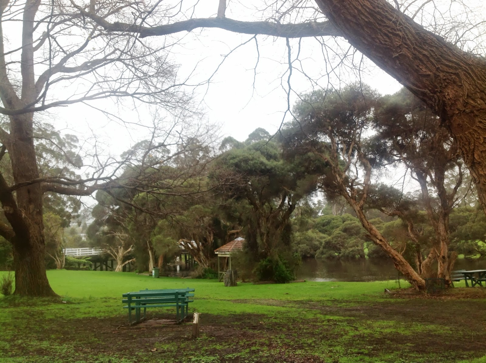
"Sunrise on the banks of the Frankland River should be a delight." (Track Guide)

Summary from the guidebook:

The track passes through the Valley of the Giants, named for the huge red tingle, which measures up to 20m round at the base, lives to 400 years, and is found nowhere else.  This is a very popular tourist attraction, and the walker is asked to allow enough time here to get up to do the famous Giants Tree Top Walk at 38m above the forest canopy, and Ancient Empire.


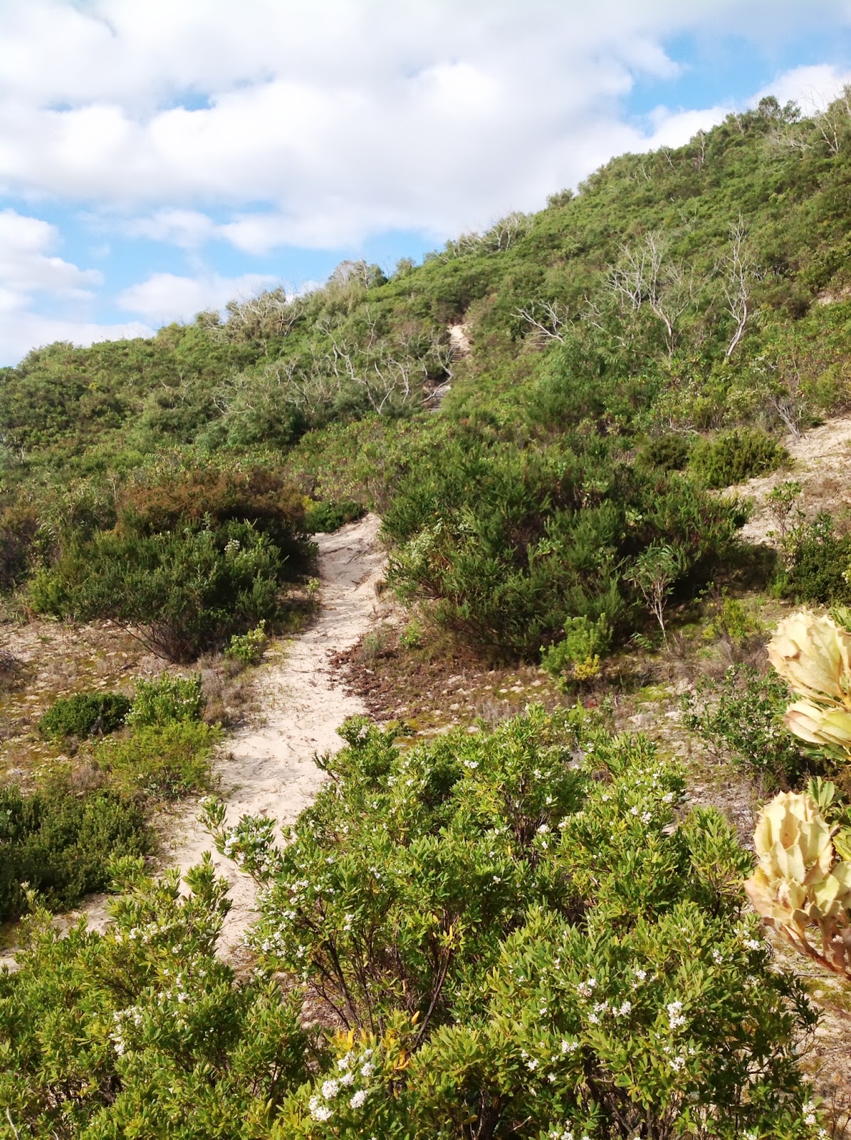
After the forest, the route heads towards the ocean at Conspicuous Bay and the walk for the remainder of the journey to Albany is on the coast. The climb up Conspicuous Cliff is tough but the views from the top are gorgeous. At this time of the year, one can expect to see up to 40 species of whales and dolphins on their annual route to feed in theAntarctic.

Weather: cloudy with welcomed snatches of sun, with occasional showers, temperature 13 deg. Celsius.
Spirits: High

Last night, I was disturbed by bush rats, and although my food was kept well away, hanging from the roof rafters, they were rustling through my bags, and the sound of the plastic bags was annoying. I even saw a bold animal scouting around.

Waking up at 5.15, I needed 1 1/2 hours to pack on my first morning. You always don't pack right the first time, so you keep adjusting.

After a meal of oats and tea with honey, I started at just after 7 determined that I would arrive early at the Tree Top Walk, a distance of about 13km. The view of the Frankland River was beautiful. Some 20 minutes into the walk, I was descending a hill and the sight of the trees bathed in early morning sun rays, the tree top shrouded with mists, was a sight that would soften any soul. At Sappers Bridge, I snapped a few pictures. The bridge was built by Australian army engineers after a flood in 1982.


Many small trees had fallen recently and some had blocked the track. I counted four places where I had to either crawl under a branch or use some gymnastics to climb over them. I even fell once, but no dramas.

At a creek crossing, I came across two day walkers who also arrived there at the same time. They watch me, impressed, using my hiking poles to good effect, and improved some sticks so they could walk across without getting their boots wet.

Creeks, where you cross them, seem to offer good photographic opportunities, and I used a bit of time taking pictures today.


By 11, I had arrived at the Tree Top Walk. We enjoyed this spot 28 years ago, and I still enjoyed it tremendously. There was also Telstra network coverage, so at 40m high and close to, but not yet reaching, the top of these giants, the red tingle, I was catching up on my email. My family got to see a picture of me at that moment, thanks to technology.

I reached the Giants Shelter at 1.30 after another easy 20 minutes walk. This time, I was pleasantly surprised there was Optus mobile coverage too. The best spot seemed to be at the dunny, so tomorrow morning, I could be making a few calls, literally.

I had bumped into Charmaine at the TTW centre. I met Charmaine last year at the Bibbulmun Track Challenge. She was kind enough to let me charge my iPad battery, so at 4, I returned there to collect my iPad. I also paid a visit to the Ancient Empire, a walk through some of the most beautiful trees, which included a red tingle named Grandma Tingle ( for obvious reasons).

The log books at shelters are always delightful to read. The Giants Shelter was no exception. But I'll share some stories in the days ahead. It's nearly 7, I've eaten my dinner, and I want to leave at sunrise so I can reach Peaceful Bay before dusk. It'll be a 30km walk. I decided to skip the next shelter. This is called 'double hutting'.