Sunday, November 21, 2021
Embracing a fall
Did you have a fall lately?
In the Moon Walk which the Bibbulmun Track Foundation organised on 20th November 2021, I tripped over a root, and I came crashing down, only Steve, walking in front of me, stopping me from sliding. My left knee was bruised, and my left palm had a small tear in the skin.
I was surprised at myself. I wasn't embarrassed even though 22 pairs of eyes watched me wash my bleeding knee. It had been a very long time since I tripped and fell flat in my bushwalks.
Perhaps, I had begun to accept my human condition. I didn't wish to hide my embarrassment.
Many people, indeed many societies, equate a fall with failure. They want to wish away a fall from grace, a fall from legitimacy, a fall from dignity, by hiding it, or pretending it never happened.
Embrace a fall.
Thursday, September 26, 2013
It's Maria's turn to complete her End to End
Just like me, Maria decided to complete walking the Bibbulmun Track before this year is out. Her
final section was from Graphite Road to Collie. I was happy to join her and two other walkers, Pete and Rob, to walk this section and celebrate Maria's transition to become an End-to-Ender.
 |
| Passing the Golden Valley Tree Park |
We set out in three cars on a cloudy September morning. Pete left his car in Collie while I left mine in Balingup. I was leaving my companions here as I could only afford five days. Chris, Maria's husband, drove us to the start of the walk in Graphite Road, a trailhead near Manjimup. We would be walking a total distance of xxx km.
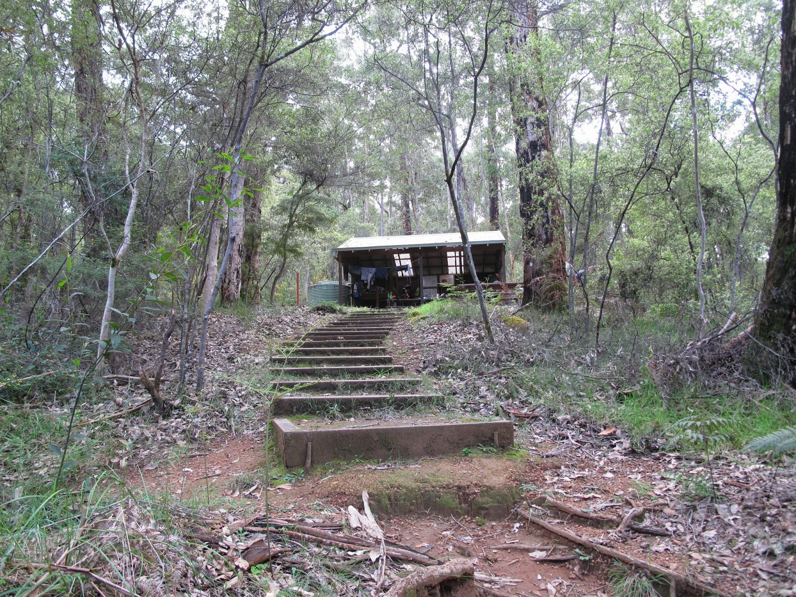 |
| Tom Road Shelter |
The first day was a short 11 km walk to the Tom Road Shelter. The Track's halfway mark, 483 km from Perth, cheered us along.
The second day was a longer 16 km walk which was also relatively easy. Our destination was the Donnelly River Village, a small community in the middle of forests. Kangaroos and emus looked like they were domesticated.
 We made the right decision of staying in a house as we learnt that it was going to be a stormy night. The best part of the stay was the hot showers and a roaring fire, for which The men managed to split dry jarrah with an axe. Meals were bought from the general store: pies and lasagna. It was nice to be able to sleep on comfortable beds and not spend the night in a shelter.

During the third day, we saw evidence of the destructive gale force winds of the night before. A 'Cockeyed Bob' had tore its way through Bridgetown, barely 30 km away from Donnelly River Village and uprooted trees and disrupting electricity supply. Our way was made difficult by tree blocks and puddles. When we arrived at Gregory Brook Shelter, we were dripping wet from rain which poured in our last hour.
This section of the Bibbulmun Track is beautiful due to its forests and wildflowers. We photographed orchids and caught bird songs.
Rob, having worked with DEC, now the Department of Parks and Wildlife, knew a lot about bird identification.
 |
| A beautiful cowslip orchid |
 |
| A species of spider orchid |
We walked through a diversion on the fourth day, caused by a burnt bridge over the Blackwood River which made the Blackwood Shelter inaccessible. Instead, hikers had the choice of camping at Wright Bridge or getting a lift to stay at Balingup. We chose the latter. Andrew, the owner of the Hikers Hideaway Backpackers, was already waiting for us when we arrived at Wright Bridge at 1pm. We were impatient to eat at the local tavern, but bad news was waiting. There was no electricity in the town, so all shops except for the general store were closed. We made our own dinner that night.

Just before reaching Balingup, we passed through the Golden ValleyTree Park which was a large arboretum planted with trees from England, the US and a few Asian countries.
 The trees were beautiful.

The fifth day was the final day of walking for me. It was beautiful countryside, up hills and down dales.
 |
| Up a slippery hill |

We arrived at Balingup at 12 noon and ate lunch at Gourmet Deli. I had smoked beef with asparagus.
It was a delicious meal.
 |
| Waiting for lunch at Gourmet Deli |
Maria, Pete and Rob would continue the next morning for the final four days to Collie. Maria would earn her badge as a new End-to-Ender. Congratulations, Maria!
Monday, September 16, 2013
A Tribute to volunteers, the Bibulmun Track Foundation and DPAW
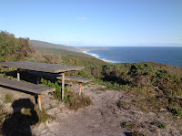
The day, September 9, 2013 marks the completion of a journey. The last bit of the journey, from Denmark to Albany, had been the most enjoyable, and most beautiful too.
 The previous day was the best day of all the days on the track. When I descended to steps to where I would meet the Torbay Inlet crossing, the beauty of the deserted beach and the peace with nature overwhelmed me with joy. Teasing the waves by walking on the firm sand where they were breaking, challenging them to come sweep me, just making out the wind turbines in the distance, and watching the sun rays blanketing them, showed me the immense power of nature, one not to be tamed but to be enjoyed.
 Steve Sertis wrote that walking the Bibbulmun Track is about the journey, not the destination. This journey saw me learn the steps, and fall a few times. I learnt about walking alone, taking responsibility, and planning. This was after I resolved to complete this journey one year ago.
But, the journey started five years back when I participated in the BT 10 year anniversary by walking one section of the track.
Steve Sertis wrote that walking the Bibbulmun Track is about the journey, not the destination. This journey saw me learn the steps, and fall a few times. I learnt about walking alone, taking responsibility, and planning. This was after I resolved to complete this journey one year ago.
But, the journey started five years back when I participated in the BT 10 year anniversary by walking one section of the track.
Then another trip with the BTF, then another. I even participated in the Corporate Challenge and had lots of fun. What was tentative at first became a serious resolution. I wanted to feel what it was like to become part of the community who complete the end to end, called End-to-Enders, even if it was by sections.
Long live the Bibbulmun Track, long live the BTF. Thank you to the volunteers and DPAW for maintaining the track. Thank you to the walkers who provided the inspiration to complete this walk, and persist in it.


 |
| A winter donkey orchid |

Thursday, September 5, 2013
Completing the E2E: Walking from Denmark to Albany, the Southern Terminus
At last, I'm approaching my goal. If everything goes well, I expect to reach the Southern Terminus on Monday, September 9, 2013. Each time, on the eve of a coming walk, I feel the days ahead are challenging enough to worry that something has not been properly taken care of, or I forgot to bring something.
The following illustrates how I planned my itinerary.
This section involves two inlet crossings: the Wilson Inlet at Denmark, and the Torbay Inlet.
Boat transfers are no longer offered (i later discovered that a new boat operator has taken over the ferry service, charging $60 for the crossing) but you can arrange for road transport to the Nullaki peninsula, which is across the inlet from the town. For this, I rang Denmark Cabs who agreed to provide this service for $50. I rang Graham, the owner of Blue Wren Backpackers, to book a bed for September 4. I felt incredulous when he emailed me to say he charged $5 each day my car was parked at his property.i decided to stay in Albany instead. This was a wiser thing to do as I would then take the bus to Denmark at the start of the walk rather than at the end.
The shelters between Denamrk and Albany are: (with distances from previous stops)
The Denmark to Albany section again promises wonderful views of the ocean, and as one leaves Denmark, there are views (behind) of the Stirling Ranges and the Porongurup Hills But first, I need to walk the section from Pemberton to Northcliffe. I set out south in my car on September 4 after waiting two days for the weather to improve.

 On the second day after leaving Denmark, I encountered heavy rain and strong winds. It was as if they knew I should have arrived at Torbay Shelter by 12 noon, and since I hadn't, I had to face the consequences. So, for two hours, I was walking in wet weather. (Why I took longer time will be told in a different story.)

The following illustrates how I planned my itinerary.
This section involves two inlet crossings: the Wilson Inlet at Denmark, and the Torbay Inlet.
Boat transfers are no longer offered (i later discovered that a new boat operator has taken over the ferry service, charging $60 for the crossing) but you can arrange for road transport to the Nullaki peninsula, which is across the inlet from the town. For this, I rang Denmark Cabs who agreed to provide this service for $50. I rang Graham, the owner of Blue Wren Backpackers, to book a bed for September 4. I felt incredulous when he emailed me to say he charged $5 each day my car was parked at his property.i decided to stay in Albany instead. This was a wiser thing to do as I would then take the bus to Denmark at the start of the walk rather than at the end.
The shelters between Denamrk and Albany are: (with distances from previous stops)
- Nullaki (13.6 km)
- West Cape Howe (16.7 km)
- Torbay (16.7 km)
- Mutton Bird (12.0 km)
- Sandpatch (13.0 km)
- Albany (13.0 km)
Starting early from Denmark, I should be able to stop in Nullaki for lunch, and walk on to the next shelter the same day. West Cape Howe to Torbay would take a day. Between Torbay and Sandpatch is a distance of only 25 km, so I could cover that in a day. And if I leave Sandpatch early, I should arrive at Albany by noon and so I could complete the walk in four days, allowing me to leave Albany on Monday, September 9. Originally, I allowed an extra day as a float in my planning.
 |
| TransWA bus schedule: Perth to Albany via Walpole |
The Denmark to Albany section again promises wonderful views of the ocean, and as one leaves Denmark, there are views (behind) of the Stirling Ranges and the Porongurup Hills But first, I need to walk the section from Pemberton to Northcliffe. I set out south in my car on September 4 after waiting two days for the weather to improve.
Friday, August 23, 2013
Day 5: Boat Harbour to Williams Bay
Weather: clear sky, temperatures rose from 11 to 27 C.
My log entry at William Bay, which I reached at 11am, says it all:
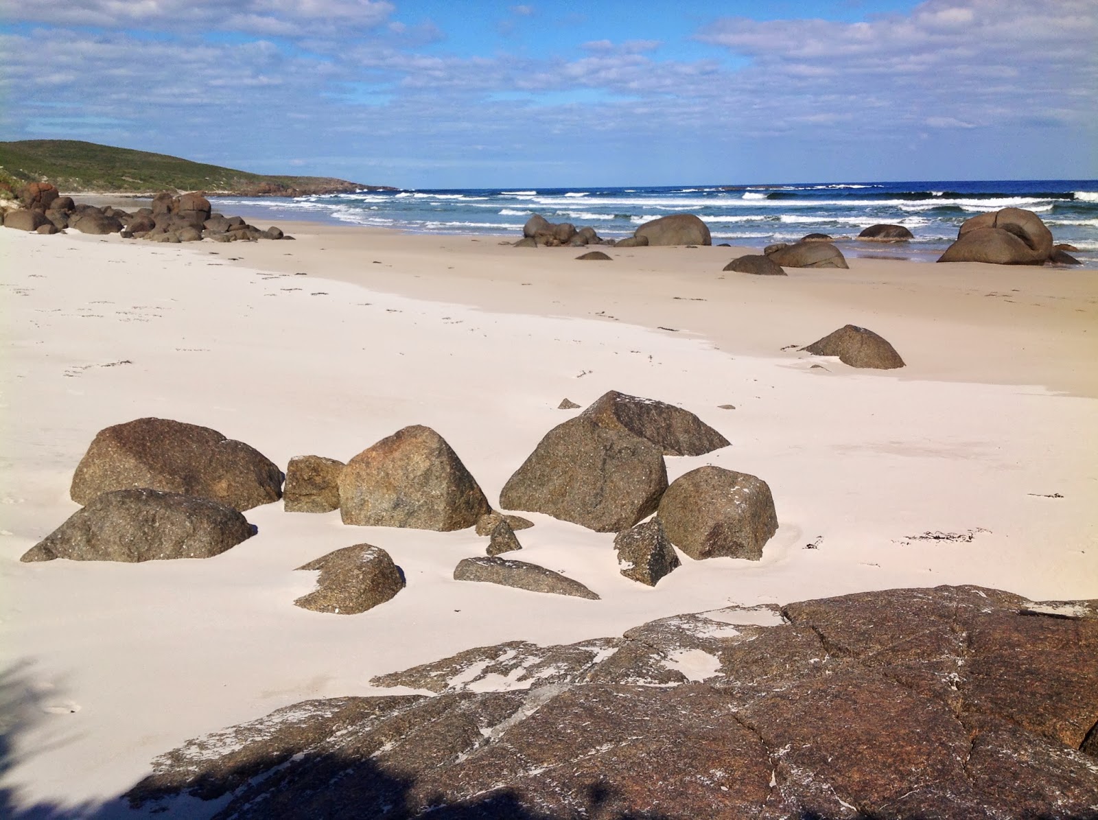
"Mazzoletti Beach was not too difficult to walk, though some parts were soft sand. After the limestone cliffs, the waves were already between 5 and 10 meters from the cliffs. It was about 10am then. I saw three surfers.
 "Earlier in the morning, I was was determined to watch sunrise. When approaching Hillier Trig Point, and crossing crest after crest, the sun was still not seen. (I quickened my pace so much that my speed at that stage could be 5km/hr.) then I realized that, walking eastwards, and because of he ridges, crests and headlands, I wouldn't be able to see the sun rising from the horizon. Anyway, it turned out that I say the sun 15 minutes after it had arisen. It still was an orange ball. Okay, not quite.


My log entry at William Bay, which I reached at 11am, says it all:
"Tomorrow is my last and sixth day, feel sorry to leave the Track. Double-hutted from Giants to Peaceful Bay, and, oh, what a long day it took. I always say, don't do it again. Anyway, I thought I could stay a night at Parry Beach if the Parry Inlet Crossing was too deep, instead of going and walk the 10km extra distance of the diversion. As it turned out, the water depth was less than a meter, but I was timing it a bit, so I would arrive well ahead of high tide, which I reckoned occurred at about 11.30 this morning. I crossed Parry Inlet at about 8.30.
 |
| Location map, captured by my Track Spotter |

 |
| 7km of Mazzoletti Beach to cross |

"One of the walkers wrote that there weren't enough waugal signs. I agree. One hour before Hillier Trig Point, I became worried that I was no longer walking on the Track as I hadn't seen a waugal for maybe an hour. At first I wasn't too concerned as surely there would be great views to be had along the coast (being not far from Boat Harbour), but to think of the several more hours to get back on track, and the much longer day ahead was unnerving.
"I started the walk from Walpole, uncertain and nifty, and carrying too much in my pack. Now, my spirits are extremely high, but my shoulders still ache, and I still carry food enough to last me another three days or more. Just because I bought a new 85 liter pack."


Green Pool, 20 minutes' walk from the base of Tower Hill, is a very beautiful swim spot. It's sheltered from the surf by rocks. Being a gorgeous and warm day, locals and tourists alike were out in full force.


Day 6: At last... Denmark, and the end of a fantastic walk!
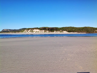
I've come at last to the end of this section of the Bibbulmun Track. I've reached Denmark, home to 5,000 residents and having a village feel about it. It's fitting that the end to a walk should allow one to spend a day here and relax.
But to reach this beautiful town, I had to descend Tower Hill, ascend Mt Halloway, and miss two turns.
The views over the ocean were spectacular as in previous days.
To conclude, I must honour my promise to share a walker's log. Here's an interesting one I found at William Bay Shelter:
I also must acknowledge with gratitude the support of the following persons:
Tracy prepared the best food I could carry with me. Acar is a great Malaysian pickle. Made from cucumber, carrot, long bean, red chili pepper, peanuts, and other vegetables, it's usually served with rice. But I found it taste superb on rice cakes. Cheese made my lunches complete.
Maria encouraged me to take the plunge and do it, although she hates it in winter. The Walpole - Albany section of the Bib Track s also Maria's favorite.

 The beautiful Light's Beach

 |
| Denmark, view over the Denmark River |
But to reach this beautiful town, I had to descend Tower Hill, ascend Mt Halloway, and miss two turns.
 |
| GPS coordinates of spot where I missed a vital waugal and walked an extra 1.5km |
The views over the ocean were spectacular as in previous days.
To conclude, I must honour my promise to share a walker's log. Here's an interesting one I found at William Bay Shelter:
Today, however ... ack! 6am start, nice morning until 9.30, then, wet set in. Drenched by overgrown bush on Mt Hallowell. Some helpful motivational type who probably has a big smug grin permanently fixed to his face and gets up at 5 am every morning for a brisk walk before a breakfast of plain oatmeal and lemongrass-pumpernickel tea with rice milk to prepare himself for another day's work as a fitness instructor for vegan orphans wrote "do it!" On the signpost pointing the spur trail to the Mt Halloway summit. Andy politely disagrees. DO NOT DO IT if it is wet or cloudy. You won't see a thing and you will get drenched by the head high plant growth across the trail. Brrr!
No damn raincoat as it broke. Rain cover for pack broke - though this can be fixed with running repairs and this is good not only cos it will keep my stuff dry but because it makes me sound like the kind of bloke who does 'running repairs' on stuff. Book got wet, which is about he only thing that could make Tolstoy more depressing,heavy rain which set in at the bottom of the hill before I got here ruined my day's walk, tea and soup, followed by more tea and soup, did some running repairs on it.
However ... however ... met my first people on the trail. Today crossed the 100 km mark - yeah! About to drink bourbon, eat peanuts and read wet To.stoy. I'm in beautiful country, and if the weather lifts, I may even get to see more than two feet at a time. And my charity page for a sick wee girl called Anna Penman back home, has just reached double its initial target. Token plug, charitygiving.co.uk/andreabudderg for more info. Life is good, and I feel great. Just keep swimming.
Happiness is finding a zip pouch on your pack you never knew was there.
Happy trails!
Andy
I also must acknowledge with gratitude the support of the following persons:
Tracy prepared the best food I could carry with me. Acar is a great Malaysian pickle. Made from cucumber, carrot, long bean, red chili pepper, peanuts, and other vegetables, it's usually served with rice. But I found it taste superb on rice cakes. Cheese made my lunches complete.
Maria encouraged me to take the plunge and do it, although she hates it in winter. The Walpole - Albany section of the Bib Track s also Maria's favorite.


Day 4: Peaceful Bay to Boat Harbour
As I type, I'm seeing a starry sky for the first time since I started in Walpole. The clouds seem to have left us. After 11 today, the sun was beating hot. Temperatures rose from 15 to 27C, so besides the fact the walk took nearly 9 hours today, it was also exceptionally hot. So I'm exhausted again.
The main highlight was canoeing across the Irwin Inlet:
After the refreshing overnight stay at Peaceful Bay, where I had a long hot shower, microwaved breakfast, electric room heating, and a mirror, it was a day on the track where the highlight was to use a canoe to cross a river mouth. An honour system ensured that a walker would always have a canoe to use.

After the crossing, there were some 7 km to cover across spectacular open heath and grassland, where kangaroos paused and stared. This part is best in spring when wildflowers are at their showiest.


This was the second day of spectacular ocean views from cliffs, walking on 2.5 km of beaches, discovering tiny snails, and hearing the incessant sounds of motorbike frogs.


The main highlight was canoeing across the Irwin Inlet:
 |
| Location of canoe crossing |
After the refreshing overnight stay at Peaceful Bay, where I had a long hot shower, microwaved breakfast, electric room heating, and a mirror, it was a day on the track where the highlight was to use a canoe to cross a river mouth. An honour system ensured that a walker would always have a canoe to use.
 |
| The mouth of Irwin Inlet: it was tempting to cross here. The water was calm . But the canoe crossing ahead was more appealing. |

After the crossing, there were some 7 km to cover across spectacular open heath and grassland, where kangaroos paused and stared. This part is best in spring when wildflowers are at their showiest.


This was the second day of spectacular ocean views from cliffs, walking on 2.5 km of beaches, discovering tiny snails, and hearing the incessant sounds of motorbike frogs.


Subscribe to:
Posts (Atom)