Wednesday, August 21, 2013

Day 2: Frankland River to Giants

"Sunrise on the banks of the Frankland River should be a delight." (Track Guide)

Summary from the guidebook:

The track passes through the Valley of the Giants, named for the huge red tingle, which measures up to 20m round at the base, lives to 400 years, and is found nowhere else.  This is a very popular tourist attraction, and the walker is asked to allow enough time here to get up to do the famous Giants Tree Top Walk at 38m above the forest canopy, and Ancient Empire.


After the forest, the route heads towards the ocean at Conspicuous Bay and the walk for the remainder of the journey to Albany is on the coast. The climb up Conspicuous Cliff is tough but the views from the top are gorgeous. At this time of the year, one can expect to see up to 40 species of whales and dolphins on their annual route to feed in theAntarctic.

Weather: cloudy with welcomed snatches of sun, with occasional showers, temperature 13 deg. Celsius.
Spirits: High

Last night, I was disturbed by bush rats, and although my food was kept well away, hanging from the roof rafters, they were rustling through my bags, and the sound of the plastic bags was annoying. I even saw a bold animal scouting around.

Waking up at 5.15, I needed 1 1/2 hours to pack on my first morning. You always don't pack right the first time, so you keep adjusting.

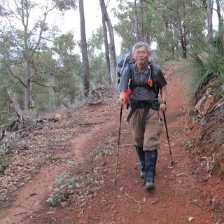
After a meal of oats and tea with honey, I started at just after 7 determined that I would arrive early at the Tree Top Walk, a distance of about 13km. The view of the Frankland River was beautiful. Some 20 minutes into the walk, I was descending a hill and the sight of the trees bathed in early morning sun rays, the tree top shrouded with mists, was a sight that would soften any soul. At Sappers Bridge, I snapped a few pictures. The bridge was built by Australian army engineers after a flood in 1982.


Many small trees had fallen recently and some had blocked the track. I counted four places where I had to either crawl under a branch or use some gymnastics to climb over them. I even fell once, but no dramas.

At a creek crossing, I came across two day walkers who also arrived there at the same time. They watch me, impressed, using my hiking poles to good effect, and improved some sticks so they could walk across without getting their boots wet.

Creeks, where you cross them, seem to offer good photographic opportunities, and I used a bit of time taking pictures today.


By 11, I had arrived at the Tree Top Walk. We enjoyed this spot 28 years ago, and I still enjoyed it tremendously. There was also Telstra network coverage, so at 40m high and close to, but not yet reaching, the top of these giants, the red tingle, I was catching up on my email. My family got to see a picture of me at that moment, thanks to technology.

I reached the Giants Shelter at 1.30 after another easy 20 minutes walk. This time, I was pleasantly surprised there was Optus mobile coverage too. The best spot seemed to be at the dunny, so tomorrow morning, I could be making a few calls, literally.

I had bumped into Charmaine at the TTW centre. I met Charmaine last year at the Bibbulmun Track Challenge. She was kind enough to let me charge my iPad battery, so at 4, I returned there to collect my iPad. I also paid a visit to the Ancient Empire, a walk through some of the most beautiful trees, which included a red tingle named Grandma Tingle ( for obvious reasons).

The log books at shelters are always delightful to read. The Giants Shelter was no exception. But I'll share some stories in the days ahead. It's nearly 7, I've eaten my dinner, and I want to leave at sunrise so I can reach Peaceful Bay before dusk. It'll be a 30km walk. I decided to skip the next shelter. This is called 'double hutting'.

Monday, August 19, 2013

Day 1: Walpole to Frankland River Shelter

"It is tempting to think that Tolkien might have used majestic trees like these as the basis of the 'Ents' of Fanghorn in 'Lord of the Rings'. So wrote Jim Baker, an experienced walker who knows the Bibbulmun Track intimately.

The hike from Walpole is considered by many as the most beautiful section of the Bib Track. Quote from "A Guide to the Bibbulmun Track":

'The Track re-enters karri and tingle forest, crossing the South Coast Highway and climbing towards the Hilltop Lookout, with lovely views over the inlet to the southern ocean. A short walk further leads to the Giant Tingle Tree tourist site, with boardwalks, trails, tables and toilets.'

After getting off the bus, the journey for which I paid $13 for the 65km distance from Denmark, I walked into the office of DPAW and said hello to Howard, the expert on track conditions. He had good news. The Parry Inlet may be passable and if I was lucky, I could walk the Mazolletti Beach.

So I started with high spirits despite the rain that started during the bus ride. The rain stopped not long after. An hour later, I was ready for lunch. As pit stop, I chose the caravan park at Coalmine Beach where a nice lady let me use the campers kitchen. And it was bliss, just munching away at my two steamy hot dumplings (chung). It was happiness in solitude, alone and one with nature, and not a bit lonely, I must add, with some hesitation.

The giant tingle tree, which I passed, was amazing. Its girth was 24m, its height 70m, and it had stood there at least 400 years. A Chinese family I met there agreed to take my photo.

Along the way, many trees had fallen due to recent storms.

I arrived at Frankland River Shelter at 4pm. It's a beauty, and what gorgeous surroundings right beside the river, which name the shelter takes after.

I spent the evening alone. Not quite, you'll see.


Sunday, August 18, 2013

Introduction to the Walpole to Denmark section, a beautiful part of the Bibbulmun Track

On the eve of the next phase of my walk on the Bib Track, I think I'm not quite prepared to hike from Walpole to Denmark, a distance of 140 km. There are the usual last minute preparations to make, chores to perform, and the final packing and re-packing the rucksack to get the weight right.

I also checked track conditions - a mandatory task in case there were bushfires, hazards or just last minute diversions. I phoned Howard, a ranger in the Walpole office of Department of Parks and Wildlife. Howard said the high rainfall had caused parts of the track to be calf-deep in water, and so I should expect more than getting just my boots wet. The canoe crossing at Irwin Inlet would be business-as-usual, but the second crossing at Parry Inlet and the beach after that may not be safe to walk, needing a 10 km detour.

In fact, I'm a little nervous. Am I fit to hike alone again over the next seven days?

I've included my iPad in my packing list, and I hope to record my journey in Bib Bytes, to share my impressions of this beautiful adventure and experimentation.

The following site gives a sneak preview of what to expect: http://www.denmarkwesternaustralia.com/denmark-australia-visitor-guides/beaches.htm for the beaches; and
http://www.denmarkwesternaustralia.com/denmark-wa-travel-destinations/valleyofthegiants.htm for the unique forests.

I've planned to drive to Denmark, stay a night at the Denmark Hotel, and then the next morning, take the TransWA bus to Walpole, 65 km away by road, to start my hike. Max, the hotel owner, has agreed to let me leave my car at the hotel carpark.

Tuesday, August 6, 2013

How to Lighten your Backpack

In long hikes, we should carry a quarter, or at most, a third of our body weight. Weighing just over 60kg, my back should carry not more than 15kg. That was indeed my pack weight for many years. I grew used to lifting and carrying this weight.

But at 58 years old, I'm beginning now to want to enjoy luxuries, things I want to use at the camp sites. A thermos flask to carry my favorite teas in winter, a pillow, some garnishing to pepper up my meals, a down jacket to keep extra warm (the warmest ones at 700+ loft can weigh more than 400 g) and a mosquito net. Together, they can add a few extra kilos to my pack.

In one overnight hike to test some new equipment, I carried 18 kg. My hike was exhausting. To be fair though, I was unfit after a month of inactivity. I decided I couldn't carry 18 kg. I needed to remove items I didn't need.

First, I looked at my rucksack. It's a One Planet McMillan with an 85 liter capacity and does the job in any multi-day hike. Made from canvas material, it's tough and durable, water-resistant and is heavier than the light weight nylon packs. I was happy to go on using it.
My McMillan weighs 3kg,  is super comfortable and has a patch

I took out things I didn't need:
  • 1.3 kg air mat, replaced by my light weight Thermarest
  • Ski jacket (I decided I would buy a down jacket)
  • Thermos flask (it wasn't winter!)
I resolved I would plan my meals properly so that, other than emergency rations, I wouldn't carry extra food. I would learn to dehydrate more of my food, and carry less fresh food.
On my Walpole to Denmark walk in August 2013, I still carried extra food. Lots, in fact. I was still lugging 19 kg. but this time, I was fitter, and, other than at the end of a long walking day, I wasn't feeling the weight.

I still had to work on how to remove heavy items.

I learnt a vital lesson too. When I neared Denmark, I noticed, with alarm, a 5-mm hole on one side of my pack. It turned out that the handle of my toothbrush, which was sticking out from the toiletry bag, had been rubbing against the canvas. It ultimately punctured it.

Sue from One Planet was happy to send me patches for the repair. However resilient the bag, no material could withstand the pressure of a protruding object, and i didnt want to look into the possibility that the damage was covered by One Planet's lifetime warranty.

So, never, never, let anything having a corner or an edge - even if it's blunt - touch the sides of a rucksack.


Monday, July 22, 2013

How to Sleep well

DHL has just delivered my long-awaited air bed cum mat. It's a large size Vaude Air Dream and I hope I will sleep comfortably while out camping.

For many years now, I've been sleeping on a self-inflating Thermarest. It's fit for purpose: light weight, pack small, and most important, keep me away from the cold floor. But I find it too narrow and a little short - mind you, I'm only 5'6". So I tend to wake up finding myself half on the ground.

I hope this new mat works. It packs larger and heavier than my Thermarest, but I can be sure it'll keep me away from the ground.

The mat is a little luxury I must have. Weighing quite a bit more, I used 15,000 Etihad miles to purchase it, and I still had to came up with US$40, but I think it's worth it.

Sleeping well is so important when out camping.

Monday, June 10, 2013

How to Make Packing Lists

Most of us plan carefully for our travels. We use checklists to keep track of what need to be done.

Packing lists become essential when it comes to bushwalking.

In one bush walk, I forgot to bring a drinking mug and tea bags, two items that I can't do without. It taught me a vital lesson: always use packing lists.

I now have lists for day trips and multi-day trips, for winter and summer. They work for me but you need to create yours. I also show equipment I own.

Day Trip

  • Daypack (Caribee 40l Starlight Rucksack)
  • Money
  • Microfibre towel
  • Packed lunch
  • First aid kit
  • Rain jacket, depending on weather (Mac in a Sac)
  • 2 1/2 liter drinking water
  • Compass, whistle

Multi-day Trip
  • Rucksack, with pack cover (85 liter One Planet McMillan)
  • Head torch with spare AAA batteries
  • Spot Tracker and compass, whistle
  • Money
  • String with pegs
  • Walking poles (Leki)
  • Sleeping bag (One Planet down bag, comfort rating 0 deg.)
  • Sleeping bag liner (Sea to Summit silk liner)
  • Track Map, or 'A Guide to the Bibbulmun Track' 
  • Notebook, pen, reading material or kindle
  • Self-inflating mat (Thermarest)
  • Light / large self-inflating pillow (Thermarest)
  • Tent (High Sierra two-man)
  • Cooking stove, with pot, pan, freshbox of matches, spoon/fork, knife, chux (cleaning cloth) (Mini Trangia set)
  • Drinking mug
  • Plastic box for lunches
  • Methylated spirits, at least 100ml per day
  • Camp sandals (Crocs, or something light)
  • Rain jacket (Mac in a Sac)
  • Clothes in dry sack: fleece jacket, socks, underwear, overnight shit & trousers
  • MicrofibreTowel
  • Toiletries (toothbrush, small tube of toothpaste, biodegradable soap, vaseline, interdental brush, comb and disposable shaver/cream for last day)
  • First aid kit, with scissors, fixamol for blisters, antiseptic cream, crepe bandages
  • Toilet paper, mini trowel
  • Food, consisting of
  1. tea bags
  2. snacks of chocolate (Kit Kat, Ritter), candy, trail mix. (Dried fruit, nuts)
  3. meals: Breakfast to consist of quick oats with nuts & dried fruit; lunch of instant  noodle with cheese, crackers with soup, or sandwiches; dinner of chickpea, ready-cooked rice, or gourmet meals
  4. Sugar, salt, butter (if cooking)
In addition ..

In Winter

  • Warm jacket, preferably a 700+ loft down jacket
  • Thermal and longjohn
  • Gloves
  • 1 1/2 liter water, including 0.5 liter hot water in thermos


In Summer

  • Mosquito net
  • Face fly net
  • 2-3 liter water


Suggestions for hiking apparel:

- mid ankle boots, one to 1 1/2 size larger to allow two pairs of socks
- gaiters (to keep out the sand, rain and even snake bites)
- broad rim hat
- wicking shirt
- long pants
- rain jacket


Wednesday, June 5, 2013

On the way to become an E2E Walker

I've completed another section of the Bib Track, this time, the section from Dwellingup to Collie. I'm well on the way to complete the entire track, a distance of 973km.


(Photo by M Binks)

 This time, I hiked 120km, took seven days, and became determined to cover the whole length this winter. The remaining sections to walk are as follows:

  1. Kalamunda to Hill Forest Discovery Centre, 18.2 km  (11/6/13, 17/6/13)
  2. Brookton Highway to Mt Cooke Campsite, 36.9 km  (23/6/13)
  3. Albany Highway to Hume Tank Road, 23.4 km    (6/8/13)
  4. Inglehope Rail Crossing to Dwellingup, 11 km  (18/6/13)
  5. Pemberton to Northcliff, 55.3 km 
  6. Walpole to Albany, 211.6 km (Completed Walpole-Denmark on 25/8/13)
 All in, a distance of 356.4 km.

 [work in progress]